

El Niño. More Than Resilience. Confidence.
As El Niño advances toward its peak later this year, the organizations that fare best won't be the ones who predicted every outcome. They'll be the ones who had visibility into changing conditions early enough to act.
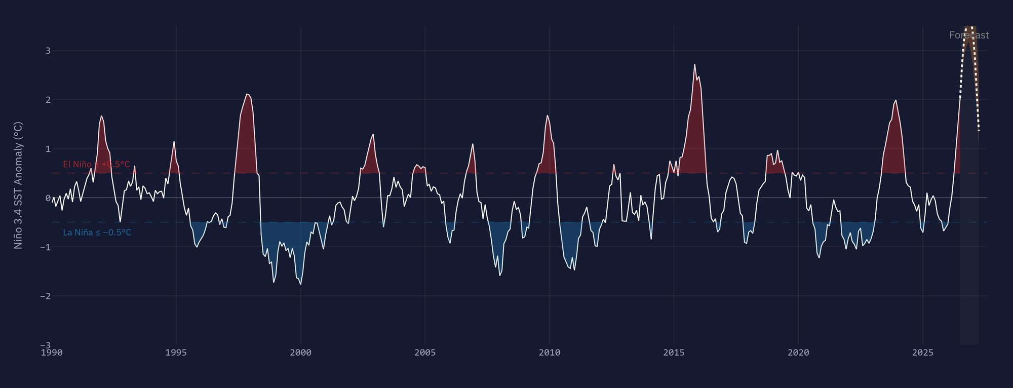
El Niño has been confirmed

ANTICIPATE
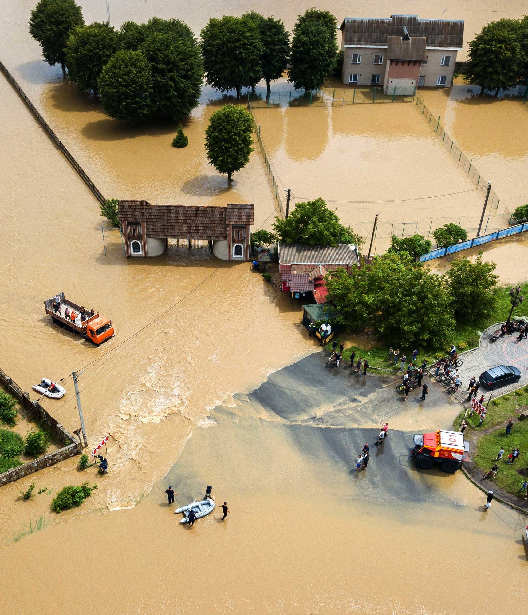
Flooding Doesn't Wait for a Forecast
Flooding has become the most common weather-related disaster worldwide, and its frequency and intensity continue to rise. Since 2000, floods have caused over $735 trillion in economic damages and more than 130,000 fatalities globally. As of 2025, 1.81 billion people — nearly one-quarter of the world's population — live in areas facing significant flood risk.
El Niño raises the stakes further. Shifting precipitation patterns can bring heavier rainfall to regions unaccustomed to it, straining rivers, reservoirs, and stormwater systems that were never designed for these conditions.
The organizations best positioned for what's ahead won't be the ones relying on national forecasts alone. National weather services provide valuable, large-scale precipitation warnings — but for the hyper-local decisions that protect specific communities, infrastructure, and residents, real-time, on-the-ground data becomes essential.
Anticipation isn't about predicting the exact moment water will rise.
It's about having the visibility to know the moment it does.
MONITOR
When Water Rises, Every Minute Matters
Real-time water level, rainfall, and flow data give decision-makers a clear picture of changing conditions — the foundation for quick response and clear communication when it matters most.
Getting the Sensor Right
Reliable flood monitoring starts with choosing the right technology for the site:
Radar level sensors
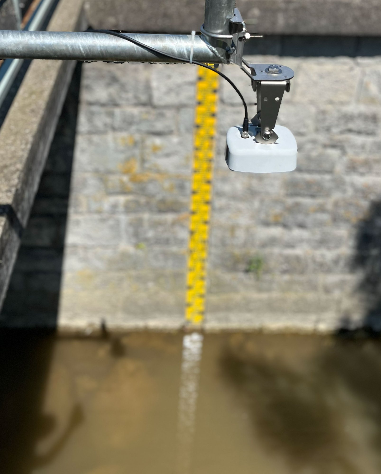
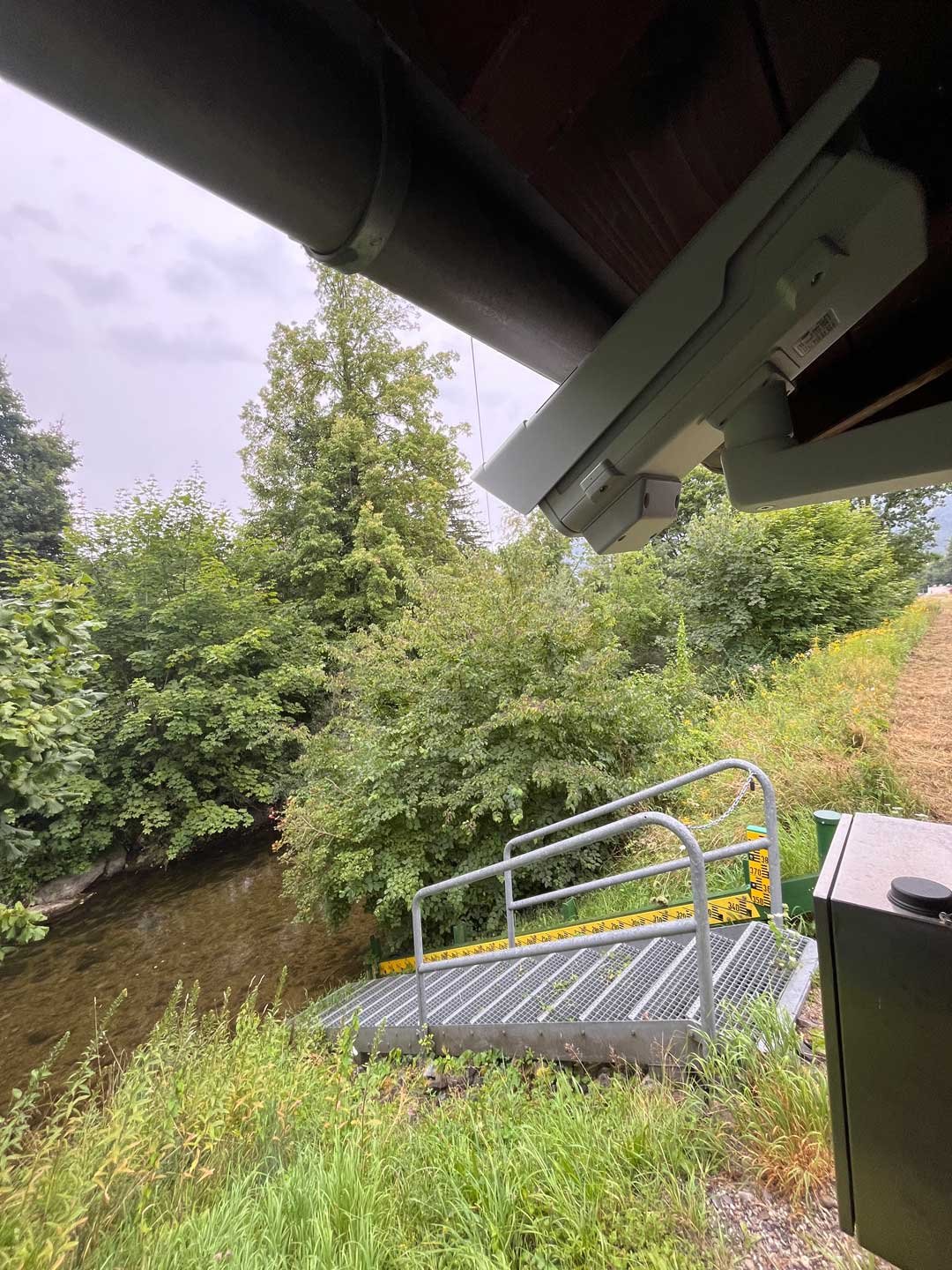
The OTT RLS 500, provide accurate, non-contact water level measurement using FMCW radar technology — critical for sites where floating debris, turbulence, or submersion risk make contact sensors impractical.
Site selection matters as much as the sensor
The beam path must be clear of obstructions, mounted away from bridge piers to avoid backwater effects, and positioned high enough to remain operational during high-water and flood conditions. Even foam or snow and ice cover on the water surface can distort a radar signal — details that separate a station that performs during a crisis from one that fails at the worst possible moment.
Measurement frequency is a flood-readiness decision
A 5-to-15-minute measurement interval is considered essential for timely flood detection, and modern dataloggers can automatically increase that frequency the moment a threshold is exceeded — balancing energy efficiency in normal conditions with real-time responsiveness when conditions escalate.
Confidence Is Rugged, Reliable Data — Even in the Storm
Flood conditions are exactly when equipment is most likely to be stressed — and exactly when it can't be allowed to fail. Rugged sensors and protective housings are engineered to keep stations running through storms, debris, and seasonal extremes, with threshold-based alerts sent automatically via text, email, or integrated systems the moment conditions change
RESPOND
From Data to Decision — When Minutes Save Lives
Monitoring only matters if it drives action in time.
In La Veta, Colorado, a wildfire that scarred 65,000 acres of upstream terrain turned a once-in-100-year flood risk into a once-in-2-years probability almost overnight. City leaders calculated that residents needed roughly two hours to safely evacuate — but with their prior system, they would only have had 32 to 45 minutes of warning.
The town's response wasn't a single sensor. It was a coordinated network — seven stations across a 13-mile radius, each measuring precipitation, water level, and surface velocity, feeding into a shared watershed data matrix. That matrix let the team distinguish between an isolated reading and a genuine multi-point threat, and made remote, two-way threshold adjustment possible as emergency managers learned more about how their watershed actually behaved.
"These instruments are key because they give us that extra element of confidence when making important decisions." — Doug Brgoch, Mayor, La Veta
As Colorado's Division of Water Resources Chief of Hydrographic Services, Matt Hardesty, put it:
"The goal of this system is to provide timely information to emergency managers without placing them in harm's way to make visual observations. It's like having eyes in the field." — Matt Hardesty, Colorado Division of Water Resources
That is what confidence looks like in hydrology: not certainty about what will happen, but the visibility to act decisively when it does.
More Than Resilience. Confidence.
NETWORK DENSITY & WATER QUALITY
One Sensor Tells You Something. A Network Tells You What It Means.
A single water level reading can raise a question. A network of readings, compiled and cross-referenced, can answer it. La Veta's approach illustrates the principle directly: one station exceeding a threshold might not be cause for alarm, but three or more, viewed together across a watershed, can signal a serious flood approaching. That kind of confidence — distinguishing noise from a genuine threat — is only possible with sufficient network density and redundant, reliable data transmission.
.png?width=960&height=960&name=Frame%20356%20(3).png)
- Building Redundancy Into the Network
Flood events are exactly when communication infrastructure is most likely to be compromised. That's why leading networks build in redundant transmission paths — cellular (including low-power LTE-M) for everyday reliability, satellite as a resilient backup when local networks fail, and LoRaWAN or hardwired LAN/DSL options depending on site accessibility and power availability. In La Veta, the team ultimately chose Iridium satellite transmission specifically because the remote terrain had little cellular coverage, with two-way capability that let emergency managers adjust alert thresholds remotely as they learned more about local conditions. - Water Quality: The Other Side of Rising Water
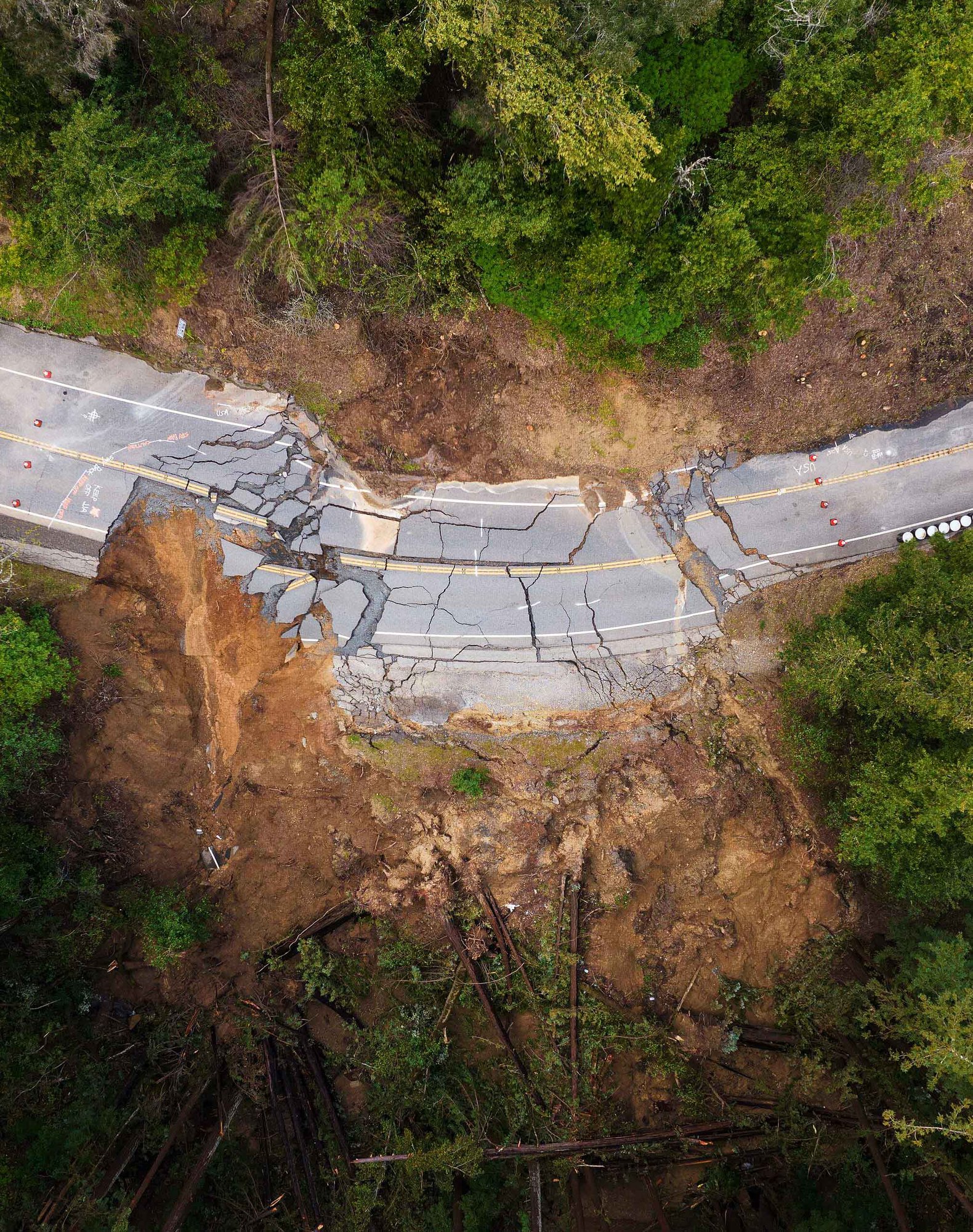
Flood monitoring is often framed purely in terms of water level — but rising water rarely arrives alone. As stream and river levels climb during heavy rainfall events, water quality can shift just as quickly: increased turbidity and sediment loading, higher risk of contamination from stormwater runoff, agricultural drainage, or combined sewer overflow, and greater strain on drinking water intakes and treatment infrastructure. For utilities and municipalities, understanding how high the water is rising is only half the picture. Understanding what's in it matters just as much, particularly for communities that draw from surface water sources or manage stormwater and wastewater systems that can be overwhelmed during extreme rainfall. Pairing level and flow monitoring with water quality parameters gives operators a fuller, more actionable understanding of flood risk — not just to property, but to public health. - Scaling as Conditions Demand It
Modern flood monitoring networks are modular by design, making it possible to add new stations, parameters, or alerting capabilities as risk conditions evolve. That matters most in a season like this one, as El Niño intensifies through its projected December 2026 peak, the communities and utilities who scale their visibility before conditions escalate will be the ones making confident decisions when it counts.
Uncertainty is not new.
With El Niño projected to peak in December 2026, the communities and utilities building monitoring density and data confidence now will be the ones with minutes to spare when it matters most.