


49 stations along the Mekong River - Cambodia - Vietnam - Laos - Thailand
The Mekong River Commission Secretariat (MRCS) is a Basin Management Organization formed through the joint-cooperation of Cambodia, Lao PDR, Thailand and Vietnam. China and Myanmar are also partners with the MRCS.
The organization aims at sustainable development on managing water resources & sharing info among the Mekong member countries. In cooperation with the World Meteorological Organization, MRC established a real-time Hydro-meteorological network, funded by the French Development Agency (FDA).
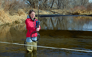
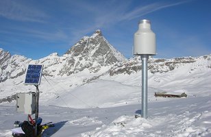
The main objective of the MRC Hydro-meteorological network is to establish an efficient, reliable and timely hydro-meteorological data collection and transmission system. The 49 network stations need to provide near-real time water level and rainfall in 15 minutes intervals.
Technology Used:
- OTT Compact Bubble Sensor
- OTT Radar Level Sensor
- OTT SE200 Shaft Encoder
- Remote data transmission systems by GPRS

OTT CBS - Compact Bubbler Sensor
Non-contact, bubbler sensor for longterm surface water level monitoring
The OTT CBS is a compact, accurate, and low power bubbler sensor for surface or groundwater level monitoring.
- Surface water Groundwater
- Bubbler-in
- Drift-free water level measurement - no pressure sensor or electronics in the water
- 0 to 15 m or 0 to 30 m
- ± 3 mm (high accuracy version); ± 5 mm (standard and 30 meter versions)
- No
- SDI-12, RS-485 (using SDI-12), or 4 ...20 mA

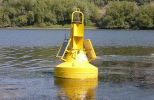
OTT RLS - Radar Level Sensor
Non-contact water level sensor for long term surface water measurements
The OTT RLS is a non-contact radar level sensor with pulse radar technology that is ideal for monitoring in remote or hard to reach locations.
- Surface water
- Water level / distance to water
- Non-contact pulse radar
- Measures water level or depth to water from a bridge, pier or mounting arm
- 0.4 … 35 m
- 0.8 … 2 m: ± 10 mm; 2 … 30 m: ± 3 mm; 30 … 35 m: ± 10 mm
- No
- SDI-12, RS-485 (using SDI-12), or 4 ...20 mA
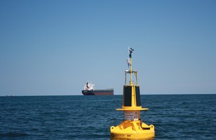
- The MRC hydro-meteorological monitoring station spatially covers both mainstream and main tributaries of the Mekong River. The station is integrated in the existing monitoring system and will also improve the national hydrological networks and river monitoring and forecasting capabilities.
- The project is managed under the Information and Knowledge Management Program (IKMP) in the Technical Support Division (TSD) of the MRC Secretariat.
- All data collected in the basin will be made available in a timely manner to the Regional Flood Management and Mitigation Center (RFMMC) in Phnom Penh and other real time users.
More details:
- Water level and rainfall measurement stations
- Remote data transmission via GPR
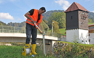
- Installation of the stations at 49 different locations in the different member countries
- Training of national technical staff
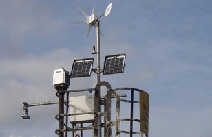
- Supply of 49 measurement stations with OTT DuoSens Data Logger as turn-key solutions for water level and rainfall measurement, data storage and remote data transmission.
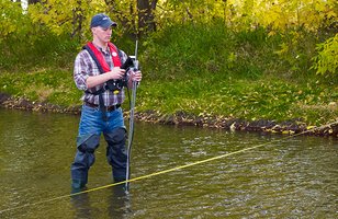
- Different water level sensor technologies applied, according to individual site conditions:
- 30 bubble sensors: OTT CBS
- 9 radar level sensors: OTT RLS
- 10 shaft encoders: OTT SE200
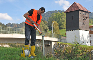
- Installation of the stations in the different member countries by local OTT partner
- Regional and national training for the operation and maintenance of the stations for the national customer staff
Advantages
- State-of-the-art technology for long-term and sustainable monitoring of hydro-meteorological data
- Turn-key solution – from sensor & data monitoring to complete installation and set-up
- Best suitable sensor technology for each different type of measurement site
- Installation: set-up and configuration of stations as well as training for customer are all handled by a local OTT partner
- Competent after-sales service provided to the MRC by local partner with support from OTT Hydroservice team in Germany